Virtual Collaroy main page | Long Reef Beach | Collaroy Rock Platform | Collaroy Beach
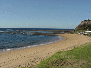
As we go North (check the map) our second study area is Collaroy rock Platform. The contrast between this headland and the two beaches is obvious. What we need to do is to consider how it was formed and what it's natural value might be. Look at the images we have here, read the information and answer the questions. To help, you can always download a question booklet from here.
The formation of the rock platform
The sandstone here is quite easy to erode but coastal processes have left a headland where this rock platform has formed. How? Check this out.
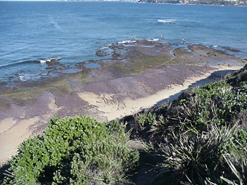
When looking at the cliff and platform it's possible to see how geology shapes the landforms. The rock beds are dipping very slightly at this point making it possible to exploit weaknesses that leave such a flat surface.
Plants and animals of the rock platform
Standing on the cliff and (very carefully!) looking over we can see that the platform seems to be divided into 3 main zones: sand, bare rock and plant-covered rock.
Q. Why do you think this is?
You'd see a range of plants and animal species. Check out this huge site with heaps of stuff on marine plants and animals (hint - head for rocky sandstone shores)
Heritage value
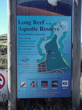
The
Long
Reef Aquatic Reserve was declared in May 1980 to protect intertidal
and subtidal marine plants and animals. It is a tied island joined by
a sandy spit to the former coastline. The 60 ha Aquatic Reserve includes
several areas of sandy beaches and rocky foreshores. The Reserve has been
set aside for the protection of marine plants and invertebrates, therefore
you can only observe. If you lift something to examine it, make sure that
you put it back in the same place. With the exception of Fin-Fish, you
cannot collect or destroy and marine plants or animals. This includes
the collection
of empty shells and dead plants or animals.