Sample Beach Profile Data
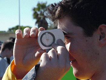
The Clinometer is used to measure angles. Get someone to stand at the end of the tape where the beach angle changes. Fix on one spot on that person which is about the same height above the ground as your eye is (which means chose your marker carefully!). Then you can read off the angle in the eyepiece (or someone can read off the angle from the side). Here, the angle is going to be negative beause it is downslope.
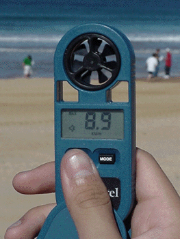
The Anemometer is a simple vane device. Just point it in the direction of the wind (usually this will be the hightest reading you can obtain) and read off the measurement on the screen. Record it!
Sample Beach Profile Data - look at this but make your own! Note that the angle is taken fresh at each location. Therefore the first reading is 5 degrees up from the origin and the second is 2 degrees downward from that point, not from the origin.
|
Profile
Poistion
|
Distance
(m)
|
Degrees
|
| swash | 20 | +5 |
| swash 2 | 14 | -2 |
| beach 1 | 3 | +11 |
| beach 2 | 35 | +2 |
| beach 3 | 15 | +10 |
| primary dune 1 | 8 | +5 |
| primary dune 2 | 7.6 | +2.5 |
| primary dune 3 | 16.5 | +3 |
| primary dune 4 | 10.5 | +1 |
| primary dune 5 | 18 | -5 |
| primary dune 6 | 17 | -5 |
Wind Speed and Direction - take a series of readings 1 minute apart on the beach and behind the primary dune. Find the mean speed and direction.
| Location | Direction | Speed 1 | Speed 2 | Speed 3 | Mean |
| Beach | 1 | 1 | 1 | 1 | 1 |
| Behind dune | 1 | 1 | 1 | 1 | 1 |